亞特蘭大-大霧山-藍嶺公路兩天游
這篇攻略是去年十一月和幾位小伙伴由 亞特蘭大 去大霧山和藍嶺公路秋游時所寫。基本按照路線走下來,但是路上走走停停,晚上六點才到大霧山腳下,去打了卡就去住的地方,準備第二天的行程了。藍嶺公路有點小小的失望,因為十一月中旬去的時候,好多葉子都掉完了。很多trial和fall也都關了。後來知道好多路段和景點十月下旬就陸續關閉了。所以想去藍嶺公路秋游的同學們,一定要提前!一定要提前!一定要提前!十月中旬去應該能看到敲美敲美的風景。亞特蘭發兩天走一個來回,時間也有點緊,如果時間充足,牆裂建議安排三天兩晚,將這個路線拆開,這條線能玩的基本都在攻略里了。最後,那個app有實時路況信息,非常使用,沿路景點也介紹的很詳細,非常實用。三月是學雷鋒月,分享給需要的小伙伴,有問題再交流。就醬!
藍嶺公路賞秋路線圖(2天1晚)
DAY 1: 亞特蘭大 ——大霧山(克林斯曼峰)——阿什維爾,總車程:6h24min, 總計309英里;其中 亞特蘭大 ——克林斯曼峰 3h 58 min,198 英里;克林斯曼峰——阿什維爾 1h46 min 75.4 英里
大霧山參考景點:
(1) Indian Creek Falls
An easy 1.6 mile roundtrip hike will allow you to enjoy two beautiful waterfalls in the Deep Creek area. Walk Deep Creek Trail 0.7 mile to the junction with Indian Creek Trail. On your way you can view elegant Tom Branch Falls located on the far side of Deep Creek. Turn right at the junction with Indian Creek Trail and proceed approximately 200' to Indian Creek Falls. The falls are 25 feet in height. Access trail: Deep Creek/Indian Creek Trailhead: Follow the signs through downtown Bryson City to Deep Creek Campground. Continue past the campground to the trailhead at the end of Deep Creek Road.
(2) Juney Whank Falls
Juney Whank Falls is divided into an upper and lower section. Both can be viewed from the footbridge which crosses Juney Whank Branch at the falls. Together they drop 90 feet from top to bottom. The trail to the waterfall is 0.8 miles roundtrip and is considered moderate in difficulty. Access Trail: Juney Whank Falls Trail Trailhead: Follow the signs through downtown Bryson City to Deep Creek Campground. Continue past the campground to the trailhead at the end of Deep Creek Road. Backtrack on foot 0.1 mile along the road to the trail
(3) Mingo Falls
Mingo Falls is on the Cherokee Indian Reservation (Qualla Boundary), just outside the national park. No special permits are required for access to the reservation. At 120 feet tall, the waterfall is one of the tallest and most spectacular in the southern mountains. The hike to the waterfall is only 0.4 miles in length, but is rated moderate in difficulty. Access Trail: Pigeon Creek Trail Trailhead: From Oconaluftee Visitor Center, drive south (toward Cherokee) on US-441 and take the second left onto Big Cove Road. At the first stop sign turn left and drive 4.5 miles to Mingo Falls Campground, where the trail begins.
(4) Oconaluftee
Highlights: historic buildings, visitor center Oconaluftee offers both a visitor center and the Mountain Farm Museum—a collection of historic log buildings gathered from throughout the Smoky Mountains and preserved on a single site. Buildings include a house, barn, applehouse, springhouse, and smokehouse. At the visitor center, rangers can answer your questions and there is a bookstore with a broad selection of guides, maps, and other products. The easy, 1.5 mile Oconaluftee River Trail begins near the entrance to the museum. It is stroller-accessible and follows the river to Cherokee, N.C. Mingus Mill, a historic, working grist mill, is 0.5 mile north of Oconaluftee. The mill is open weekends from late March and daily from mid-April through mid-November. Oconaluftee is 1.0 mile north of Cherokee, NC on US-441.
 去程總路線: 亞特蘭大 ——克林斯曼峰——阿什維爾
 去程分路線1: 亞特蘭大 ——克林斯曼峰
 去程分路線2:克林斯曼峰——阿什維爾
Day 2: 阿什維爾——藍嶺公路—— 亞特蘭大 ,總車程4h 25 min, 總計221 英里。其中藍嶺公路段1h41 min, 60.6英里。藍嶺公路末端—— 亞特蘭大 2h 50 min, 162英里
 返程總路線:阿什維爾——藍嶺公路—— 亞特蘭大
藍嶺公路段觀光景點:
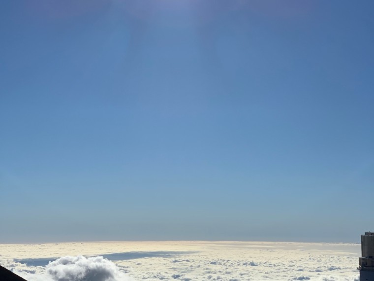
(1) MP 451.2 ,Waterrock knob and visitor center
360 degree view from waterrock knob ,including great balsams, great smokies, cowees, nantahalas, blue ridge, newfound mountains, blacks, and craffies.( MP 451.2, waterrock knob trail)
參考照騙:


(2) MP 408.6 Mount Pisgah
Lodge, restaurant,picnic
Mount Pisgah trail: 1.3 miles,pass through a Northern Red Oak forest, spectacular view including the French Broad River Valley and shining Rock Wilderness
Birthplace of forestry in Ametica-----Cradle of Forestry
參考照騙:


(3) MP 382 , Folk Art Center
Folk art associated with the southern Appalachians ,including music, dance and storytelling as well as crafts. 9.am----6.pm


(4) MP 384, Parkway vistor center(次要)
Newest parkway facilities with an award-wining film and interactive high tech exhibits on the natural, cultural and recreational resources of the region.


返程分路線1:藍嶺公路段
返程分路線2:藍嶺公路末端—— 亞特蘭大
 此次秋游行程總路線:
備註:
(1) 去程和返程分別經過chattahochee national forest 和nantahala national forest 中部和東部,可沿途欣賞兩公園秋景。

(2) 參考時間:DAY 1 因取車可能會耽誤時間,預計10點 亞特蘭大 出發,加上路上休息時間,預計3點左右到克林斯曼峰。30-60min後啟程前往阿什維爾,預計6點到達阿什維爾,晚餐休息;如果達到克林斯曼峰時間較晚,可以考慮看日落(5.32 P.M),然後返回阿什維爾,則預計8點到達阿什維爾。
DAY2 九點從阿什維爾出發,藍嶺公路段車程1h40min,總計60.6英里游玩時間預計2h,12點40離開藍嶺公路出發返程,返程途中休息並吃午飯,預計下午五點左右返回 亞特蘭大 。(時間好像太充足。。。)
以上均是參考時間,可根據實際行程靈活調整。
(3) 藍嶺公路全長470英里,本路線參觀路段為其最南端大約60英里長度;

(4) 阿什維爾簡介:阿什維爾(英語:Asheville)位於 美國 北卡羅來納州 西部,是班 康縣 的縣治。根據2000年 美國 人口普查,共有68,889人,其中白人占77.95%、非裔 美國 人占17.61%。此地酒店較多,可以有較多選擇,是藍嶺公路旅游主要住宿地之一
 阿什維爾酒店分佈及價格(來自谷歌地圖)
(5) 藍嶺公路沿途觀景景點稍後添加。
(6) 更多信息可見藍嶺公路APP,如下。
(7) 加油點
MP469


(8) https://twitter.com/smokiesroadsnps 大霧山實時路況信息
(9) Emergency Information
Emergency Numbers
Dial 911 or call the Park Emergency Line at (865) 436-9171
Area Hospitals
Blount Memorial Hospital
907 E Lamar Alexander Parkway
Maryville, TN
(865) 983-7211
LeConte Medical Center
742 Middle Creek Road
Sevierville, TN
(865) 446-7000
map of hospital
Swain County Hospital
45 Plateau Street
Bryson City, NC
(828) 488-2155
map of hospital
Haywood Regional Medical Center
262 Leroy George Drive
Clyde, NC
(828) 456-7311
2018/11/09
藍嶺公路賞秋路線圖(2天1晚)
DAY 1: 亞特蘭大 ——大霧山(克林斯曼峰)——阿什維爾,總車程:6h24min, 總計309英里;其中 亞特蘭大 ——克林斯曼峰 3h 58 min,198 英里;克林斯曼峰——阿什維爾 1h46 min 75.4 英里
大霧山參考景點:
(1) Indian Creek Falls
An easy 1.6 mile roundtrip hike will allow you to enjoy two beautiful waterfalls in the Deep Creek area. Walk Deep Creek Trail 0.7 mile to the junction with Indian Creek Trail. On your way you can view elegant Tom Branch Falls located on the far side of Deep Creek. Turn right at the junction with Indian Creek Trail and proceed approximately 200' to Indian Creek Falls. The falls are 25 feet in height. Access trail: Deep Creek/Indian Creek Trailhead: Follow the signs through downtown Bryson City to Deep Creek Campground. Continue past the campground to the trailhead at the end of Deep Creek Road.
(2) Juney Whank Falls
Juney Whank Falls is divided into an upper and lower section. Both can be viewed from the footbridge which crosses Juney Whank Branch at the falls. Together they drop 90 feet from top to bottom. The trail to the waterfall is 0.8 miles roundtrip and is considered moderate in difficulty. Access Trail: Juney Whank Falls Trail Trailhead: Follow the signs through downtown Bryson City to Deep Creek Campground. Continue past the campground to the trailhead at the end of Deep Creek Road. Backtrack on foot 0.1 mile along the road to the trail
(3) Mingo Falls
Mingo Falls is on the Cherokee Indian Reservation (Qualla Boundary), just outside the national park. No special permits are required for access to the reservation. At 120 feet tall, the waterfall is one of the tallest and most spectacular in the southern mountains. The hike to the waterfall is only 0.4 miles in length, but is rated moderate in difficulty. Access Trail: Pigeon Creek Trail Trailhead: From Oconaluftee Visitor Center, drive south (toward Cherokee) on US-441 and take the second left onto Big Cove Road. At the first stop sign turn left and drive 4.5 miles to Mingo Falls Campground, where the trail begins.
(4) Oconaluftee
Highlights: historic buildings, visitor center Oconaluftee offers both a visitor center and the Mountain Farm Museum—a collection of historic log buildings gathered from throughout the Smoky Mountains and preserved on a single site. Buildings include a house, barn, applehouse, springhouse, and smokehouse. At the visitor center, rangers can answer your questions and there is a bookstore with a broad selection of guides, maps, and other products. The easy, 1.5 mile Oconaluftee River Trail begins near the entrance to the museum. It is stroller-accessible and follows the river to Cherokee, N.C. Mingus Mill, a historic, working grist mill, is 0.5 mile north of Oconaluftee. The mill is open weekends from late March and daily from mid-April through mid-November. Oconaluftee is 1.0 mile north of Cherokee, NC on US-441.
Day 2: 阿什維爾——藍嶺公路—— 亞特蘭大 ,總車程4h 25 min, 總計221 英里。其中藍嶺公路段1h41 min, 60.6英里。藍嶺公路末端—— 亞特蘭大 2h 50 min, 162英里
藍嶺公路段觀光景點:
(1) MP 451.2 ,Waterrock knob and visitor center
360 degree view from waterrock knob ,including great balsams, great smokies, cowees, nantahalas, blue ridge, newfound mountains, blacks, and craffies.( MP 451.2, waterrock knob trail)
參考照騙:
(2) MP 408.6 Mount Pisgah
Lodge, restaurant,picnic
Mount Pisgah trail: 1.3 miles,pass through a Northern Red Oak forest, spectacular view including the French Broad River Valley and shining Rock Wilderness
Birthplace of forestry in Ametica-----Cradle of Forestry
參考照騙:
(3) MP 382 , Folk Art Center
Folk art associated with the southern Appalachians ,including music, dance and storytelling as well as crafts. 9.am----6.pm
(4) MP 384, Parkway vistor center(次要)
Newest parkway facilities with an award-wining film and interactive high tech exhibits on the natural, cultural and recreational resources of the region.
返程分路線1:藍嶺公路段
返程分路線2:藍嶺公路末端—— 亞特蘭大
備註:
(1) 去程和返程分別經過chattahochee national forest 和nantahala national forest 中部和東部,可沿途欣賞兩公園秋景。
(2) 參考時間:DAY 1 因取車可能會耽誤時間,預計10點 亞特蘭大 出發,加上路上休息時間,預計3點左右到克林斯曼峰。30-60min後啟程前往阿什維爾,預計6點到達阿什維爾,晚餐休息;如果達到克林斯曼峰時間較晚,可以考慮看日落(5.32 P.M),然後返回阿什維爾,則預計8點到達阿什維爾。
DAY2 九點從阿什維爾出發,藍嶺公路段車程1h40min,總計60.6英里游玩時間預計2h,12點40離開藍嶺公路出發返程,返程途中休息並吃午飯,預計下午五點左右返回 亞特蘭大 。(時間好像太充足。。。)
以上均是參考時間,可根據實際行程靈活調整。
(3) 藍嶺公路全長470英里,本路線參觀路段為其最南端大約60英里長度;
(4) 阿什維爾簡介:阿什維爾(英語:Asheville)位於 美國 北卡羅來納州 西部,是班 康縣 的縣治。根據2000年 美國 人口普查,共有68,889人,其中白人占77.95%、非裔 美國 人占17.61%。此地酒店較多,可以有較多選擇,是藍嶺公路旅游主要住宿地之一
(5) 藍嶺公路沿途觀景景點稍後添加。
(6) 更多信息可見藍嶺公路APP,如下。
(7) 加油點
MP469
(8) https://twitter.com/smokiesroadsnps 大霧山實時路況信息
(9) Emergency Information
Emergency Numbers
Dial 911 or call the Park Emergency Line at (865) 436-9171
Area Hospitals
Blount Memorial Hospital
907 E Lamar Alexander Parkway
Maryville, TN
(865) 983-7211
LeConte Medical Center
742 Middle Creek Road
Sevierville, TN
(865) 446-7000
map of hospital
Swain County Hospital
45 Plateau Street
Bryson City, NC
(828) 488-2155
map of hospital
Haywood Regional Medical Center
262 Leroy George Drive
Clyde, NC
(828) 456-7311
2018/11/09